Geo view
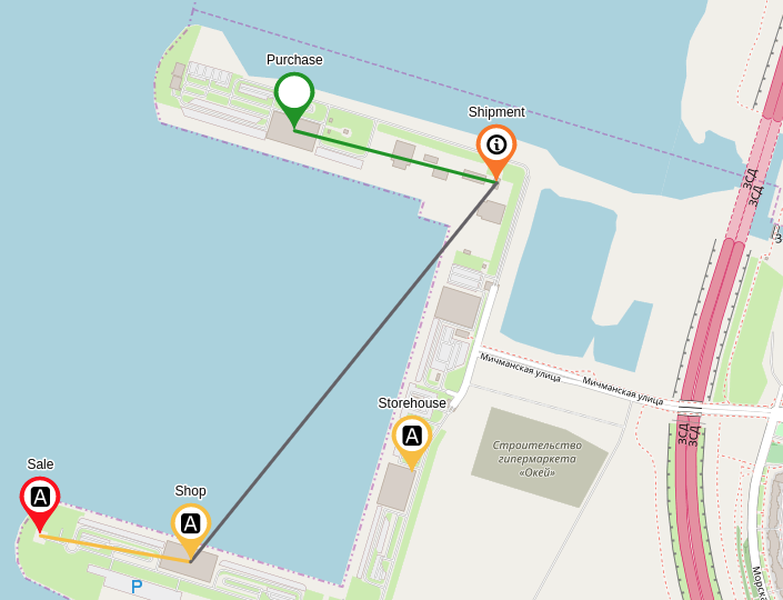
It is possible to set coordinates for objects and browse the objects on the map. It can be convenient in case of geographical distributed infrastructure. For example, Internet provider’s network equipment (routers, switches) can be associated with physical addresses to provide visual map.
|
In the section geoMap of the client configuration file it is possible to set up:
|
| When the first opening an object in its Geo view, the point with average latitude and longitude of the child objects is at the center of the map. |
Map displacements and scale changes are kept in the browser for next Geo view openings.
When this view is turned on, child objects with coordinates and links between them are displayed on the map. The color of the marker corresponds to the current object state.
| The Geo view does not support links creation and flows creation and displaying. |
Geo radius is the radius of the object action area or approximate location of the object on the map in meters. For example, the radius of the action area of a basic station or a car location. The color of the zone corresponds to the color of the object state.
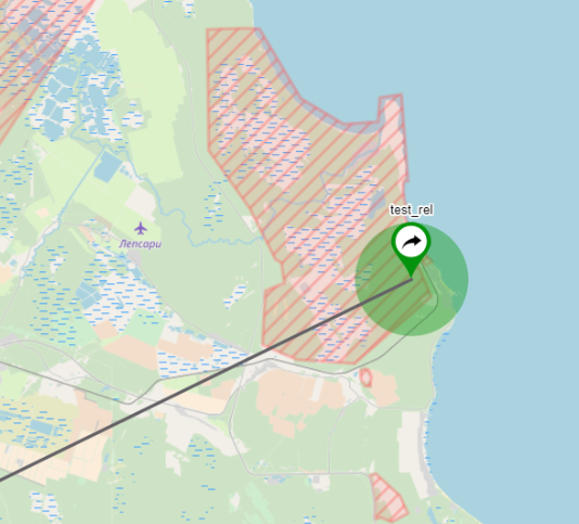
| Geoposition and geo radius can be set in the General parameters of an object. |